By Mylynka Kilgore-Cardona, PhD, Map Curator, Archives and Records, Texas General Land Office
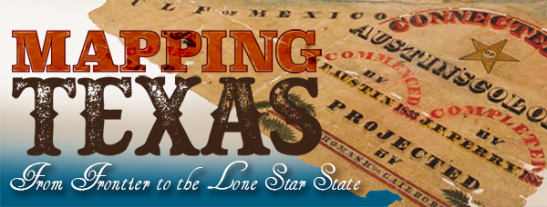
In the nearly four hundred years that it took for Texas to take its current shape, the space changed from an extensive, unexplored and sparsely settled frontier under the Spanish Crown to its iconic and easily recognizable outline. Mapping Texas: From Frontier to the Lone Star State traces the cartographic history of Texas from the sixteenth to the twentieth century, from contested imperial claims that spanned the continent to individual rights of ownership all with the understanding that in order for a place to be claimed, it needed to be mapped. Over fifty rare maps from the collections of the Texas General Land Office and the personal collection of Frank and Carol Holcomb, of Houston, are on display. Additional maps are on loan from The Bryan Museum in Galveston and the Witte Museum in San Antonio. This exhibit runs at the Houston Museum of Natural Science through October 8, 2017

Frontiers of Discovery: “The Great Space of Land Unknown”
European cartographers imagined the territory that became Texas as a vast region eager to be claimed and colonized despite the existence of indigenous communities. Mapmakers borrowed from native informants, European explorers’ writings and other printed sources to chart coastal areas and waterways and ease the navigation and exploration of the territory. Their vague, and often contradictory, information led to contested claims that fueled further exploration. These campaigns spurred the eventual establishment of fortifications and cities from which to govern the territory. While Spain and France made inroads into territorial claims in Texas, England concerned itself with charting the waters of the Gulf
The oldest map in the exhibit is Martin Waldseemüller’s Tabula Terre Nove [The Admiral’s Map].[1] Based on Portuguese charts and Spanish reports, this woodcut map is one of the first maps of the Americas to appear in an atlas. Published in 1513 as part of Johann Schott’s edition of Ptolemy’s Geographia, this map presented evidence of the New World’s existence. Though North and South America are joined together by a continuous coastline, the Gulf of Mexico is recognizable as are the islands of Cuba (Isabella) and Haiti (Spagnolla). The area that would become Texas is almost unidentifiable, with no text or features included save for the gulf coast.


The map shows all four continents of the Atlantic World – North and South America, Europe, and Africa. The islands off the northwest African coast, which were colonized by Portugal, are also shown. The only European city noted on the map is Lisbon, Portugal – the departure point for many of the New World explorations in the sixteenth century.[2] South America is listed as terra incognita, unknown land, and other than a few coastal rivers the Americas are wholly blank.


Waldseemüller’s woodcut is a landmark map in the history of mapping the Americas. Not only was Waldseemüller an eminent cartographer of this First Age of Exploration, he was a humanist scholar that helped “revolutionize the traditional concepts of global geography.”[3]
This map is part of the Frank and Carol Holcomb Digital Map Collection at the Texas General Land Office.
Can’t make it to Houston? You can view the majority of the maps in this exhibit in high definition on the GLO’s website where you can also purchase reproductions of the maps and support the Save Texas History program.
Martin Waldseemüller, Tabula Terre Nove [The Admiral’s Map], Strasbourg, 1513, Map #93800, Frank and Carol Holcomb Digital Collection, Archives and Records Program, Texas General Land Office, Austin, TX.
Detail of the Gulf Coast with the few known rivers marked.
Detail of the islands of Isabella (Cuba) and of Spagnolla (Haiti) as well as other nearby islands in the Caribbean.
Detail of map showing England, Ireland, France, and the Iberian Peninsula (Spain and Portugal). The port city of Lisbon is marked.
Detail of West Africa showing the Canary Islands and others claimed by Portugal and Spain.
Detail of South America with the Equator and Tropic of Capricorn marked. Coastal town and known rivers are also indicated.
[1] Scholar’s debate exactly who Waldseemüller means with the title “The Admiral’s Map,” but the consensus is that he is referring to Amerigo Vespucci.
[2] For more information on the city of Lisbon see http://www.golisbon.com/
[3] https://www.raremaps.com/gallery/detail/33884/Tabula_Terre_Nove_The_Admirals_Map/Waldseemuller.html